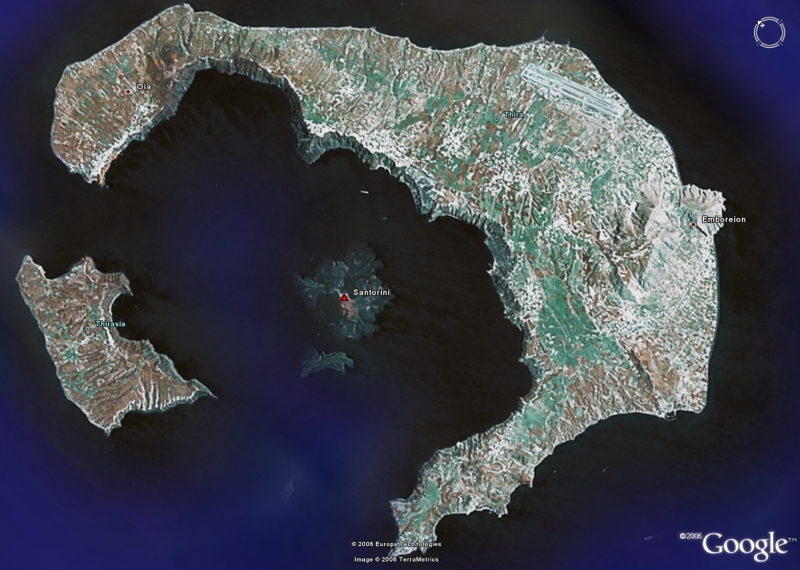
| Santorini01 | This is the Google Earth
image of Santorini. I included it because Santorini is too big to be
captured in pictures taken from ground level. Here you see Santorini
from the top. Santorini is what's left from a gigantic volcanic
explosion in 1500 BC; the large island is about half of the top of the
volcano. The smaller island at left is another part of the top. There
are two parts missing that result in the two gaps. In the center is
another island that is actually the top of a huge cinder cone in the
center of the old crater.
There are two main towns on Santorini. Fira, the larger one, is the white stuff at the edge of the cliff at about the 1 o'clock position from the center island. Ia is on the left side of the main island, also right on the cliff. Our ship stopped about half way between the center island and the Fira coast. |


|